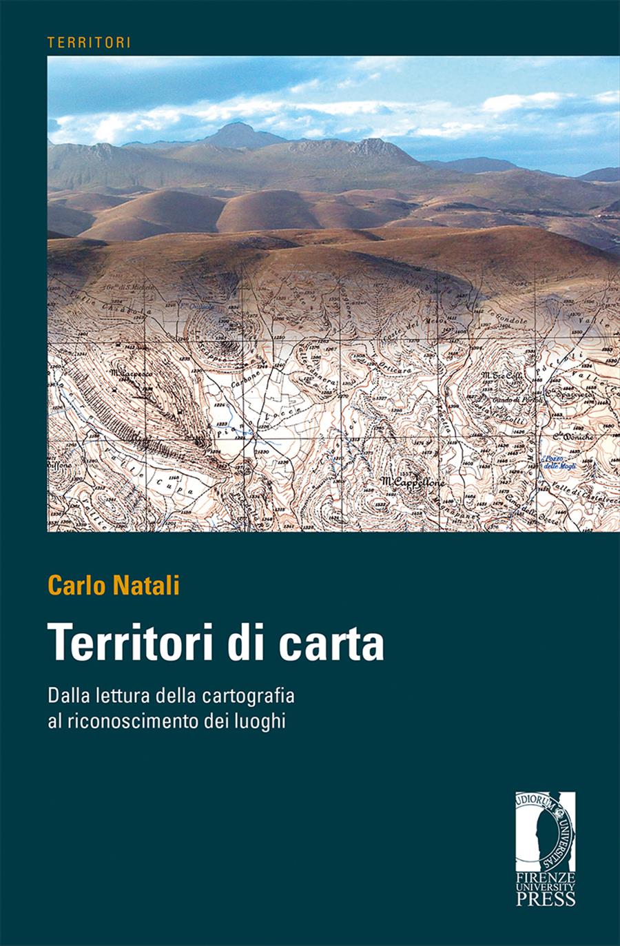
Territori di carta
Dalla lettura delle carte al riconoscimento dei luoghi
- Carlo Natali,
Cartography represents places through symbols related to forms, dimensions and signs. By the meticulous decoding of all these signs and their connexions the user is enabled to enter the deep identity of places considered. The book is based on a rational consequential method by which the user can get the necessary information from the map in order to understand and imagine the represented places, so as to use it for personal aims. The book is primarily intended for specialists or students of territory, but also for hikers who use maps on excursions or just for people who are curious and interested in deepening their knowledge of territory.
- Keywords:
- Cartography,
- territory and landscape identity,
- methodology,
- interdisciplinary approach,
- DOI: 10.36253/978-88-5518-089-4
- Series: Territori
- Scientific Board
- Language: Italian
- Subjects: Architecture City Planning
University of Florence, Italy - ORCID: 0000-0001-8787-551X
He is author of urban plans for public entities and presently studies mountain settlements.
- AA.VV. (2011). "Elementi di topografia e catasto".Torino: UTET.
- Allen, P. (1993). "Storia della cartografia". Milano: Mondadori.
- Aruta, P. & Marescalchi, D. (2005). "Cartografia. Lettura delle carte". Bologna: Flaccovio.
- Bellia, P. (1991). "Elementi di cartografia". Bologna: Esculapio.
- Biasutti, R. (1947). "Il paesaggio terrestre". Torino: UTET.
- Boca, D. & Oneto, G. (1986). "Analisi paesaggistica". Milano: Pirola.
- Boffi M., Scienza dell’informazione geografica, Zanichelli, Bologna, 2004.
- Campbell, J. (1984). "Introductory Cartography". Englewood Cliffs N.J.: Prentice Hall Inc. Ed. it. (1989). "Introduzione alla cartografia". Bologna: Zanichelli.
- Camporesi, P. (1992). "Le belle contrade". Milano: Garzanti.
- Caniggia, G. (1976). "Strutture dello spazio antropico". Firenze: Uniedit.
- Capello, C.F. (1968). "La lettura delle carte topografiche e l’interpretazione dei paesaggi". Torino: Giappichelli.
- Casti, E. (Ed.) (2007). "Cartografia e progettazione territoriale. Dalle carte coloniali alle carte di piano". Torino: UTET.
- Castiglioni, G.B. (1991). "Geomorfologia". Torino: UTET.
- Catizzone, A. (2007). "Fondamenti di cartografia". Roma: Gangemi.
- Cecioni, E. (1987). "Uso della carta topografica". Firenze: Istituto Geografico Militare.
- Cerreti, C., Federzoni, L. & Salgaro, S. (2010). "Cartografia di paesaggi. Paesaggi nella cartografia". Bologna: Pàtron
- Clementi, A. (Ed.) (2004). "Interpretare il paesaggio". Roma: Meltemi.
- Clementi, A., Dematteis, G. & Palermo, P.C. (Eds). (1996). "Le forme del territorio italiano. Temi ed immagini del mutamento". Bari: Laterza.
- D’Apostoli, R. (2009). "Prontuario di topografia". Rimini: Maggioli.
- De Rossi, A., Durbiano, G., Governa, F., Reinerio, L. & Robiglio, M. (Ets). (2006). "Linee nel paesaggio. Esplorazioni nei territori della trasformazione". Torino: Utet.
- Dematteis, G. (1985). "Le metafore della terra". Milano: Feltrinelli.
- Di Pietro, G. & Fanelli, G. (1968). "Città murate e sviluppo contemporaneo - 42 centri della Toscana". Lucca: CISCU.
- Donadieu, P. (2006). "Campagne urbane". Roma: Donzelli.
- Farinelli, F. (1992). "I segni del mondo. Immagine cartografica e discorso geografico in età moderna". Firenze: La Nuova Italia.
- Ferrara, G. (Ed.) (1976). "Risorse del territorio e politica di piano". Venezia: Marsilio.
- Gambi, L. (1961-1979). "Leggere il paesaggio". Bologna: Zanichelli.
- Gambino, R. (1997). "Conservare innovare. Paesaggio, ambiente, territorio". Torino, Utet.
- Giovannini, C. & Torresani, S. (2004). "Geografie". Milano: Mondadori.
- Guidi, F. (1978). "Fotogrammetria, fotointerpretazione, telerilevamento". Firenze: Istituto Geografico Militare.
- Istituto Geografico Militare (vari). "Segni convenzionali e norme sul loro uso". Firenze: Istituto Geografico Militare
- Istituto Geografico Militare, Italia (vari). "Atlante dei tipi geografici". Firenze: IGM.
- Lanzani, A. (2003). "I paesaggi italiani". Roma: Meltemi.
- Lodovisi, A. & Torresani, S. (1996). "Storia della cartografia". Bologna: Pàtron
- Magnaghi, A. (Ed.) (2000). "Rappresentare i luoghi. Metodi e tecniche". Firenze: Alinea.
- Magnaghi, A. (Ed.) (2005). "La rappresentazione identitaria del territorio. Atlanti, codici, figure, paradigmi per il progetto locale". Firenze: Alinea.
- McHarg, I. (1969). "Design with nature". Garden City, New York: Natural History Press. Ed. it. (1989). "Progettare con la natura". Padova: Franco Muzzio&C.
- McKnight, T.L. & Hess, D. (2005). "Geografia fisica. Comprendere il paesaggio". Padova: Piccin.
- Mioni, A. (1999). "Metamorfosi d’Europa. Popolamento, campagne, infrastrutture e città". Bologna: Compositori.
- Natali, C. (1998). "Risorse e analisi del territorio". Firenze: Alinea.
- Natali, C. (2004). "L’analisi delle risorse nella formazione del piano strutturale". Firenze: Alinea.
- Oneto, G. (2001). "Manuale di architettura del paesaggio". Firenze: Alinea.
- Panizza, M. (2007). "Geomorfologia". Bologna: Pitagora.
- Pirola, A. & Vianello, G. (1992). "Cartografia tematica ambientale". Roma: NIS.
- Repetti, E. (1833-1846). "Dizionario Geografico Fisico Storico della Toscana" (Vols. 6). Firenze: Tofani.
- Rizzo, G.G. (Ed.) (2004). "Leggere i luoghi". Roma: Aracne.
- Romani, V. (1988), "Il paesaggio dell’Alto Garda bresciano". Brescia: Grafo edizioni.
- Romani, V. (2008). "Il Paesaggio. Percorsi di studio". Milano: Franco Angeli.
- Sauro, U., Meneghel, M., Bondesan, A. & Castiglioni B.(2011). "Dalla carta topografica al paesaggio. Atlante ragionato". Firenze: Istituto Geografico Militare.
- Schiavi, A. (2008). "Vademecum cartografico. Informazioni per l’analisi e le letture delle carte geografiche e topografiche". Bologna: Vita e Pensiero.
- Sereni, E. (1961-74)." Storia del paesaggio agrario italiano". Bari: Laterza.
- Sestini, A. (1963). "Il paesaggio". Milano: Touring Club Italiano.
- Steiner, F. (1991). "The living landscape, an ecological approach to landscape planning". New York: McGraw Hill. Ed. it. (2004). "Costruire il paesaggio. Un approccio ecologico alla progettazione del paesaggio" (2nd ed.). Milano: McGraw Hill.
- Strahler, A. (1984). "Geografia Fisica". Padova: Piccin.
- Turco, A. (1988). "Verso una teoria geografica della complessità". Milano: Unicopli.
- Turri, E. (1979). "Semiologia del paesaggio italiano" Milano: Longanesi.
- Turri, E. (2002) "La conoscenza del territorio. Metodologia per un’analisi storico-geografica". Venezia: Marsilio.
- Vallega, A. (2004). "Le grammatiche della geografia". Bologna: Pàtron.
- Zerbi, M.C. (1993). "Paesaggi della geografia". Torino: Giappicchelli.
- Zorzi, R. (1999). "Il paesaggio. Dalla percezione alla descrizione". Venezia, Marsilio.
- Publication Year: 2020
- Pages: 224
- eISBN: 978-88-5518-089-4
- Content License: CC BY 4.0
- © 2020 Author(s)
- Publication Year: 2020
- Pages: 224
- ISBN: 978-88-5518-088-7
- Content License: CC BY 4.0
- © 2020 Author(s)
Bibliographic Information
Book Title
Territori di carta
Book Subtitle
Dalla lettura delle carte al riconoscimento dei luoghi
Authors
Carlo Natali
Peer Reviewed
Number of Pages
224
Publication Year
2020
Copyright Information
© 2020 Author(s)
Content License
Metadata License
Publisher Name
Firenze University Press
DOI
10.36253/978-88-5518-089-4
ISBN Print
978-88-5518-088-7
eISBN (pdf)
978-88-5518-089-4
eISBN (xml)
978-88-5518-090-0
Series Title
Territori
Series ISSN
2704-5978
Series E-ISSN
2704-579X
